Our community is facing one of the most significant winter storms in recent memory as a fierce Nor'easter continues to batter the East Coast with life-threatening conditions. The massive storm system, which began Sunday night, has transformed our neighborhoods into winter landscapes while creating dangerous travel conditions and widespread power disruptions.
Record Snowfall Hits Close to Home
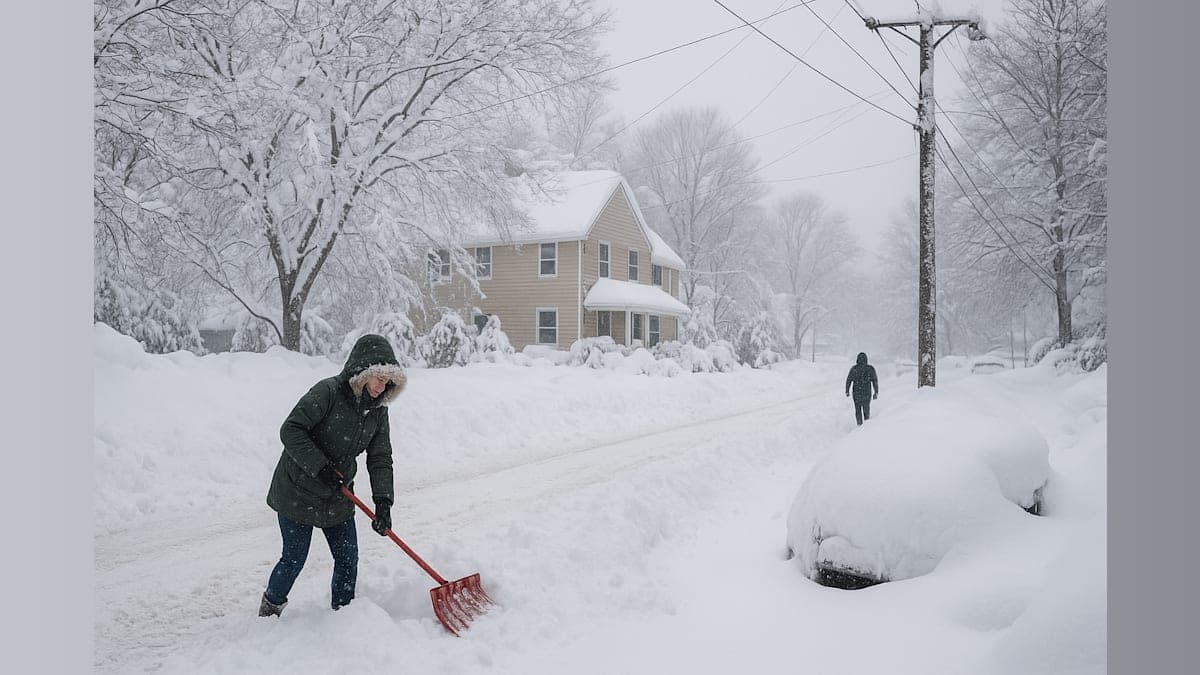
By Monday morning, our region was experiencing truly historic snowfall totals. Freehold, New Jersey emerged as one of the hardest-hit areas, recording an impressive 24.2 inches by 8:30 a.m. Neighboring communities weren't far behind—Perth Amboy and Chatham both measured 20 inches, while Newark saw 18.3 inches and Westfield reported 18 inches of accumulation.
The storm's impact varied across the broader region, with Long Island recording 20 inches, New York City seeing around 9 inches, Philadelphia receiving 6.5 inches, and New Haven, Connecticut measuring 9.9 inches. According to meteorologists, some areas could ultimately see as much as three feet of snow before this system moves out.
Power Outages Leave Hundreds of Thousands in the Dark
The combination of heavy, wet snow and powerful winds has taken a severe toll on our power infrastructure. As of Monday morning, more than half a million customers across the Northeast were without electricity. Massachusetts led the region with 182,000 outages, while New Jersey counted 130,000 customers in the dark. Delaware, Maryland, New York, Pennsylvania, Virginia, and Connecticut all reported significant outages as well.
"Wind gusts over 50 mph can result in near-whiteout conditions and drifting where the snow is not as wet," explained AccuWeather Chief Meteorologist Jonathan Porter. "Especially in Southeast New England, eastern Long Island and southern New Jersey, the combination of heavy wet snow and strong winds could bring down tree branches and power lines."
Blizzard Conditions Create Dangerous Travel Situations
This storm has brought true blizzard conditions to our area, with wind gusts reaching 35-60 mph along the coast and visibility dropping to near-zero in many locations. The technical definition of a blizzard—sustained winds over 35 mph with visibility of a quarter-mile or less for at least three consecutive hours—has been met and exceeded across much of our region.
Snow has been falling at rates of 1-3 inches per hour, overwhelming even the most prepared road crews and leaving many motorists stranded. Over 5,000 flights were canceled Monday, with major disruptions at airports in Philadelphia, New York City, and Boston creating a ripple effect across the country. Rail and bus services have also been suspended in many areas.
What to Expect in the Coming Days
The good news is that conditions are gradually improving as the storm system moves northward. Areas in the southern part of the affected region, including Philadelphia and eastern Pennsylvania, began seeing relief Monday morning. For our communities in New York, New Jersey, and western Connecticut, conditions are expected to improve around midday, though eastern areas including Boston and Cape Cod will continue to experience heavy snow and high winds into the evening.
However, residents should prepare for new challenges. As colder air returns Monday night and persists through Tuesday, any slush and standing water will refreeze, creating treacherous conditions for Tuesday morning commuters. Minor coastal flooding is also possible during high tide cycles, along with beach erosion from Delaware to Massachusetts.
Community Resilience Shines Through
While this storm has certainly tested our community, it's also reminded us of our collective strength. Neighbors are checking on neighbors, utility crews are working around the clock to restore power, and emergency services continue to respond despite the challenging conditions. As we move through the recovery phase, that spirit of cooperation will be more important than ever.
If you're still dealing with power outages or hazardous conditions, please stay safe, avoid unnecessary travel, and check on vulnerable community members. This storm may have been one for the record books, but our community's response will be remembered long after the snow melts.