A powerful Nor'easter is bearing down on our community, and meteorologists are warning residents to take this storm seriously. The system is expected to intensify dramatically overnight Sunday, February 22, into Monday, February 23, bringing what AccuWeather Chief Meteorologist Jonathan Porter is calling a "blockbuster blizzard."
The most dangerous conditions will occur during a critical 10-hour window between 1 a.m. and 11 a.m. Monday morning, when our region could see snowfall rates of 2 to 4 inches per hour combined with wind gusts of 50 to 70 mph. These conditions will create whiteout scenarios that could leave travelers stranded and overwhelm even the most prepared road crews.
What to Expect in Our Area
Snow accumulations will vary significantly across the Northeast. New York City and Philadelphia are projected to receive between 10 and 14 inches of snow, while Boston could see 12 to 18 inches. Parts of Long Island and Cape Cod may be buried under 18 to 24 inches. Areas farther south, including Baltimore and Washington, DC, will see lighter totals of 3 to 6 inches and 1 to 3 inches respectively.
"In the heaviest snow bands, there can be thunder and lightning with snowfall rates of 2 to 4 inches per hour, overwhelming plow crews and making it nearly impossible to keep roads passable," Porter explained.
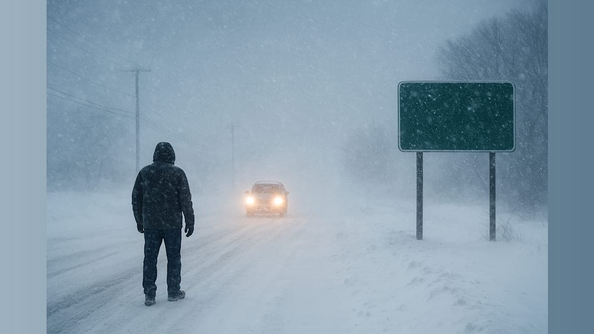
Travel Will Be Treacherous
Our community should prepare for significant travel disruptions. Thousands of flights are expected to be canceled at major regional airports, including those serving New York City, Boston, and Philadelphia. Rail and bus services may be suspended, and major highways could become impassable for extended periods.
"People attempting to drive through this storm could end up stranded for hours in dangerous conditions," Porter warned. If you don't absolutely need to travel Monday morning, stay home. This is not a storm to underestimate.
Power Outages Likely
The combination of heavy, wet snow and powerful winds creates significant risk for widespread power outages. Areas most vulnerable include parts of New Jersey, southern New York (particularly eastern Long Island), Rhode Island, Connecticut, and Massachusetts. The weight of accumulated snow on power lines, combined with wind gusts that could snap tree branches, means some residents could be without electricity for an extended period.
"Take this winter storm seriously," Porter emphasized. "Keep your cell phone charged and have a plan in case you lose power and heat."
Coastal Communities Face Double Threat
Residents in coastal areas should prepare for a one-two punch. In addition to heavy snowfall, coastal flooding and beach erosion are expected along the Mid-Atlantic and New England coasts, with the greatest risks occurring during high tide cycles. Coastal communities need to be ready for both the snow and the surge.
Historic Storm Potential
This storm has the potential to be one for the record books. The last time Boston experienced true blizzard conditions was in March 2018. For Philadelphia, residents would have to reach back more than three decades to the March 1993 blizzard to find a comparable event.
Prepare Now
With the worst conditions expected to arrive in the early morning hours Monday, now is the time to prepare. Stock up on essential supplies, charge all electronic devices, and ensure you have adequate heating alternatives if power goes out. Clear your schedule for Monday if possible—this is a day to hunker down at home.
As the storm departs Monday night into Tuesday, February 24, colder air will sweep in, causing any remaining slush and wet spots to refreeze. This will create additional hazards for Tuesday morning commuters, so even after the snow stops, conditions will remain dangerous.
We'll continue monitoring this developing situation and provide updates as conditions evolve. Stay safe, neighbors, and look out for one another during this significant winter storm.