Our community needs to prepare for a significant winter storm as blizzard warnings blanket the region from Saturday through Monday evening. The National Weather Service has issued urgent warnings for Delaware, New Jersey, New York, and southern Connecticut, with conditions expected to turn dangerous by Sunday morning.
A strengthening low-pressure system tracking from the Great Lakes toward the Mid-Atlantic coast will intensify offshore late Saturday, bringing heavy snow and punishing northeasterly winds across our area. The storm's timing couldn't be worse—it will impact both Monday morning and evening commutes with potentially life-threatening conditions.
What to Expect in Your Area
The National Weather Service Mount Holly issued blizzard warnings early Friday morning for Delaware's Inland Sussex and Delaware Beaches, including Georgetown and Rehoboth Beach. These areas can expect 6 to 12 inches of snow beginning at 1:00 PM Saturday through 6:00 PM Monday, with wind gusts reaching 55 mph.
New Jersey residents face even more severe conditions. Eastern and western Monmouth, Ocean, Coastal Ocean, and southeastern Burlington counties should prepare for blizzard conditions starting at 10:00 AM Saturday. These areas could see a staggering 12 to 20 inches of snow, with snowfall rates potentially exceeding 2 inches per hour during the height of the storm.
Along the Jersey Shore, Atlantic City and Ocean City residents in Atlantic, Cape May, and coastal counties face 10 to 18 inches of accumulation beginning at 1:00 PM Saturday. Significant blowing and drifting snow will create hazardous conditions well after the precipitation ends.
The NWS New York office placed all five boroughs of New York City, along with parts of Connecticut including Southern Fairfield, Southern New Haven, Southern Middlesex, and Southern New London counties, under blizzard warnings from 6:00 AM Saturday through 6:00 PM Monday. These areas should prepare for 13 to 18 inches of snow and wind gusts up to 55 mph.
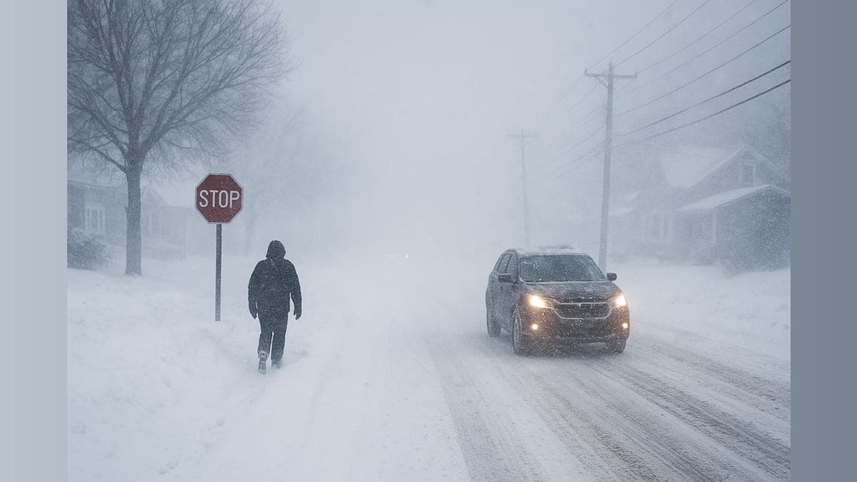
Dangerous Conditions Expected
The most severe conditions will develop Sunday night into Monday. Visibility may drop below a quarter mile in falling and blowing snow, creating whiteout conditions that make travel extremely dangerous. The combination of heavy, wet snow and strong winds poses a serious threat to trees and power lines, with sporadic outages likely across the region.
Weather officials are urging residents to restrict travel to emergencies only. A blizzard warning means severe winter weather conditions are imminent, with falling and blowing snow and strong winds combining to produce whiteout conditions.
How to Prepare
Our community should take immediate steps to prepare for this significant storm. Stock up on essential supplies, charge electronic devices, and ensure you have flashlights and batteries in case of power outages. If you must travel, the National Weather Service advises carrying a winter survival kit in your vehicle and remaining with your car if you become stranded.
Check on elderly neighbors and those who may need assistance preparing for the storm. Many local municipalities will be activating emergency operations centers and may declare snow emergencies, so stay tuned to local officials for the latest guidance.
This is shaping up to be one of the most significant winter storms our region has seen this season. By preparing now and heeding official warnings, we can help keep our community safe through this dangerous weather event.