
Tropical Storm Arthur has formed as the first named storm of the Atlantic hurricane season, bringing the immediate threat of dangerous flooding to communities along the northwestern Gulf Coast. The system is currently positioned 40 miles east-northeast of Port Connor, Texas, according to the National Hurricane Center.
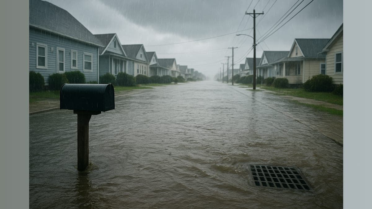
Arthur's maximum sustained winds have reached 40 mph, just above the 39 mph threshold required for tropical storm classification. While forecasters do not anticipate significant strengthening, the National Hurricane Center warns that dangerous flash floods and urban flooding remain serious concerns as the system moves northeast toward southwestern Louisiana, where landfall is expected Wednesday night.
The rainfall projections paint a concerning picture for Gulf Coast residents. The hurricane center advisory indicates that Arthur is expected to produce rainfall totals of 5 to 10 inches along a large portion of the United States coast of the Gulf of Mexico, with isolated higher totals approaching 20 inches through early Friday.
NHC Director Michael Brennan emphasized the prolonged nature of the threat during an online briefing. "The main threat from Arthur is going to be a prolonged multi-day heavy rainfall event that could produce dangerous to life-threatening flash flooding," Brennan stated. He noted that areas from the Texas coast to South Georgia are currently under flood watch advisories.
Brennan further warned that the rainfall threat will persist even after Arthur's center moves inland and dissipates, which is expected to occur Wednesday night or early Thursday. The danger extends hundreds of miles inland, making this a concern for communities well beyond the immediate coastal areas.
A tropical storm warning remains in effect from High Island, Texas, to Morgan City, La., indicating that tropical storm conditions are expected within 12 hours. All of Southeast Texas is under a flood watch until 7 p.m. Wednesday, according to Houston Public Media. Officials in Galveston County are urging residents not to attempt driving through flooded streets.
Arthur's formation arrives slightly ahead of historical patterns. Based on data from 1991 to 2020, the average date for the first named Atlantic storm is June 20, according to the hurricane center. The average date for the first Atlantic hurricane to occur over that same span is August 11.
Climate change continues to intensify hurricane behavior, as warmer sea water evaporates more readily, providing additional fuel for storm systems. Warmer air can also hold substantially more water, resulting in heavier rainfall events.
The Atlantic storm season forecast calls for fewer storms than average, the National Hurricane Center said in May. The recently declared El Niño will likely make it more difficult for hurricanes to form in the Atlantic Ocean. However, warmer ocean waters increase the likelihood that a large and destructive hurricane could develop this season. Forecasters stress that it only takes one large, powerful storm to bring life-threatening rainfall and storm surges capable of devastating areas far inland from the coast.