Our community is still recovering from the massive nor'easter that blanketed the region with historic snowfall, but Mother Nature isn't giving us much of a break. Two more winter systems are tracking toward the Northeast this week, bringing fresh challenges for residents already working overtime to clear driveways and sidewalks.
The first system, a clipper storm moving across the Great Lakes, will arrive Tuesday evening through Wednesday. While major cities along the I-95 corridor from Washington, D.C., to Philadelphia and New York City may see a mix of rain and snow, our neighbors farther north and inland should prepare for 1 to 3 inches of accumulation.
What to Expect This Week
The second storm will move more quickly, arriving late Thursday into Thursday night. This system presents a more complex forecast, with the potential for a band of snow north of its track, while areas along the southern edge could experience a messy mix of rain, snow, and ice. Communities farther south might see plain rain or even thunderstorms.
Wednesday offers a brief reprieve with temperatures climbing into the 40s across much of our region, which should help melt some of the existing snow. However, this temporary warmth comes with a catch—overnight temperatures will plunge back near or below freezing, creating dangerous icy conditions on roads, sidewalks, and parking lots.
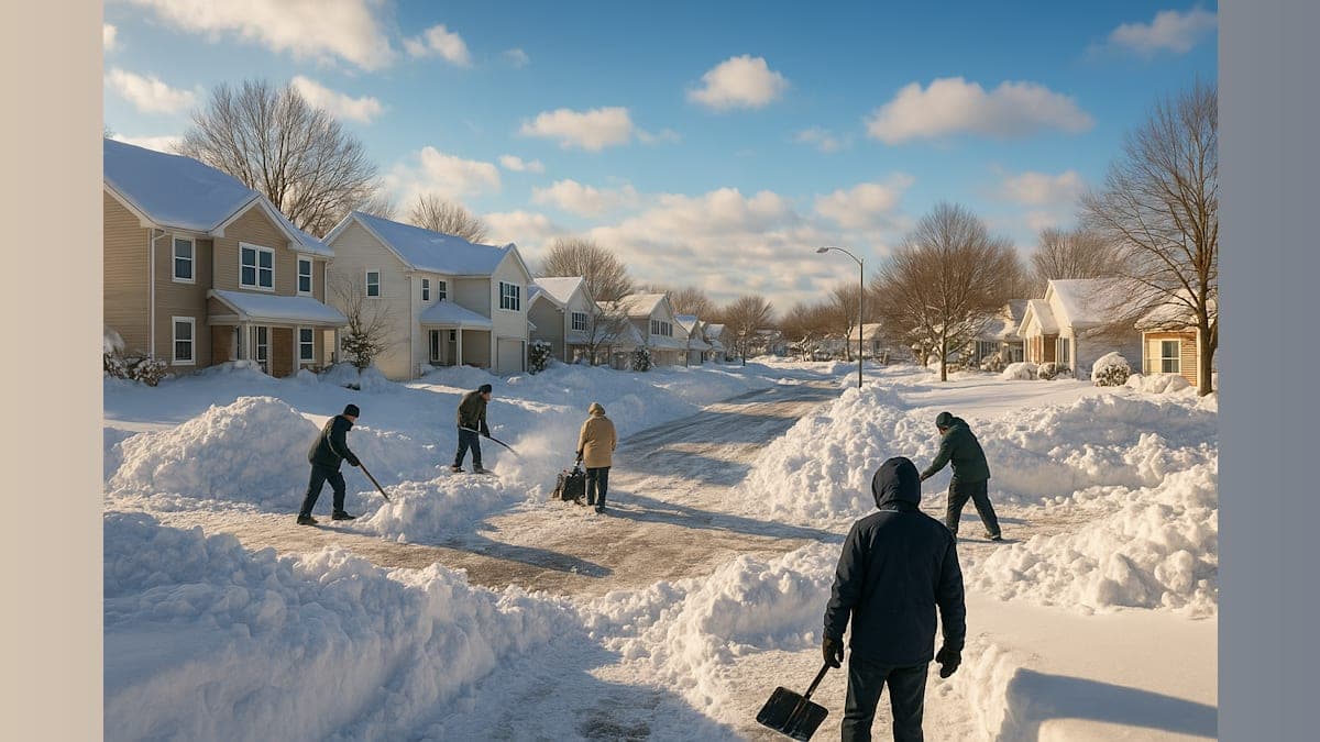
The Toll of the Historic Blizzard
We're still assessing the full impact of last week's blockbuster storm, which delivered more than a foot of snow across widespread areas. Weather experts now estimate the total damage and economic loss from that single storm at between $34 billion and $38 billion—a staggering figure that underscores just how disruptive extreme winter weather can be to our communities and businesses.
AccuWeather Chief Meteorologist Jonathan Porter emphasized an important reminder: "Many people assume the most dangerous and destructive weather in America happens in the summer and fall months during hurricane and wildfire seasons, but extreme weather can strike any time of year."
Staying Safe as Cleanup Continues
The bitter cold that moved in behind the historic storm has frozen slush and standing water, making untreated surfaces treacherous. While Tuesday's high temperatures will hover around freezing, the February sun should provide a few hours of limited melting during midday.
Local officials urge residents to remain vigilant as these new systems approach. Travel disruptions are likely to continue throughout the week, affecting both personal commutes and business operations. If you haven't already, now is the time to stock up on essentials like salt, sand, and emergency supplies.
As our community works together to dig out from one historic storm, we're reminded of our resilience and the importance of looking out for one another. Check on elderly neighbors, help clear fire hydrants on your block, and give yourself extra time for travel as conditions change rapidly.
We'll continue monitoring these developing weather systems and bringing you updates as conditions evolve. Stay warm, stay safe, and remember—we've weathered challenges like this before, and we'll get through this one together.